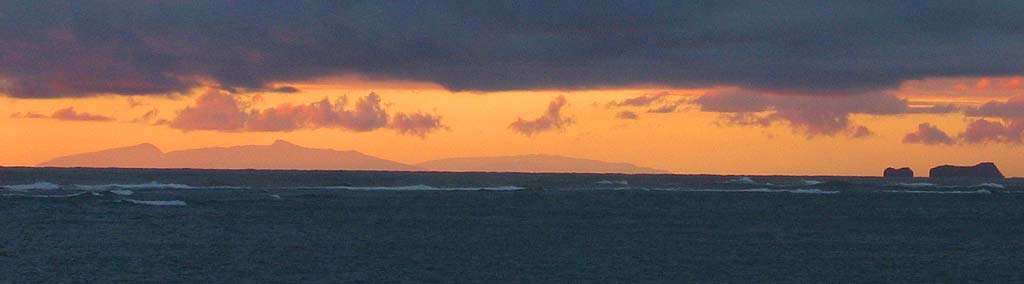
| What do we see from Kaaawa? My current reckoning.... |
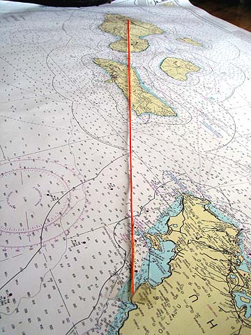 |
| I stretched out this nautical chart, cut a length of string, and placed one end on the point on the coast marking our approximate vantage point on the beach in Kaaawa. I then set the string so it passed just to the left of the Mokumanu Islands off Mokapu Point, and then on in a straight line. This appears to be approximately our line of sight.
The string crosses the middle of Molokai and goes on to Maui, directly behind Molokai. The highest peaks on Molokai, all on the higher East end of the island (farther away from Oahu), lie to the left of the string. The highest peaks on Maui, including the summit of Haleakala and the highest point in the West Maui Mountains, are lined up to the right of the string. And remember, given the distance from Oahu, we can only see the higher elevations of either island. It's somewhat counter intuitive, but the West end of Molokai, which is actually closest to Oahu, is below the horizon and can't be seen from here.
So what do we see? I have to conclude that on the left, we have a cross-section of Molokai's higher elevations, seen across the length of the island, with two high peaks of the East End rising above the rest of the island. Then, on the right, we see Haleakala, with either the West Maui Mountains or the West end of Molokai in the foreground, but visually merged with the larger but more distant Haleakala. And on an exceptionally clear day, we can see just sliver of Lanai on the horizon in the small visual gap between Mokapu and the Mokumanu Islands just off the extreme right of this photo. Or perhaps we just see the clouds that might sit above Lanai. I'm just not sure. So that's my working hypothesis, but I'm interested in hearing from those less than convinced by my explanation. Earlier entries: |